DHL Abholort 4.69 Hermes Kurierdienst 4.99 DHL-Kurier 3.99 Hermes-Stelle 4.49 GLS-Kurierdienst 3.99

Wildland Fire Danger Estimation And Mapping: The Role Of Remote Sensing Data

Sprache EnglischEnglisch
Buch Hardcover
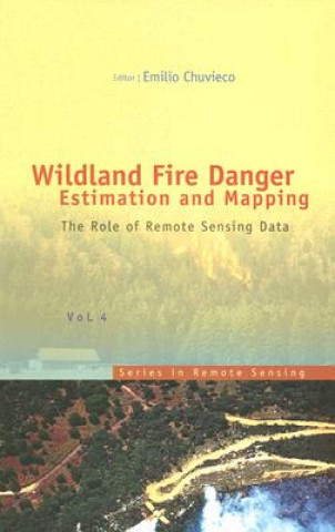
Buch Wildland Fire Danger Estimation And Mapping: The Role Of Remote Sensing Data Emilio Chuvieco
Libristo-Code: 05067623
The book presents a wide range of techniques for extracting information from satellite remote sensin... Vollständige Beschreibung
? points 514 b DEMNÄCHST DEMNÄCHST
204.97 inkl. MwSt.
Erwarteter Nachdruck Termin unbekannt Termin unbekannt

30 Tage für die Rückgabe der Ware


Das könnte Sie auch interessieren


Nature morte Louise Penny / Broschur
common.buy 15.42
Sämtliche Erzählungen Friedrich von Schiller / Broschur
common.buy 4.03
Perspectives on HCI Research with Teenagers Linda Little / Hardcover
common.buy 119.53
Cakewalk Lee Smith / Broschur
common.buy 22.49
Wars of German Unification Dennis Showalter / Hardcover
common.buy 243.00
Python Data Visualization Cookbook Igor Milovanovic / Broschur
common.buy 52.85
Sinking of the Titanic and Great Sea Disasters Marshall Logan / Broschur
common.buy 44.88
Autobiography and National Identity in the Americas Steven V. Hunsaker / Hardcover
common.buy 84.63
Triticale: Today and Tomorrow Henrique Guedes-Pinto / Hardcover
common.buy 413.59

The book presents a wide range of techniques for extracting information from satellite remote sensing images in forest fire danger assessment. It covers the main concepts involved in fire danger rating, and analyses the inputs derived from remotely sensed data for mapping fire danger at both the local and global scale. The questions addressed concern the estimation of fuel moisture content, the description of fuel structural properties, the estimation of meteorological danger indices, the analysis of human factors associated with fire ignition, and the integration of different risk factors in a geographic information system for fire danger management.

Informationen zum Buch

Vollständiger Name Wildland Fire Danger Estimation And Mapping: The Role Of Remote Sensing Data
Sprache Englisch
Einband Buch - Hardcover
Datum der Veröffentlichung 2003
Anzahl der Seiten 280
EAN 9789812385697
ISBN 981238569X
Libristo-Code 05067623
Gewicht 582
Abmessungen 163 x 234 x 18
Verschenken Sie dieses Buch noch heute
Es ist ganz einfach
1 Legen Sie das Buch in Ihren Warenkorb und wählen Sie den Versand als Geschenk 2 Wir schicken Ihnen umgehend einen Gutschein 3 Das Buch wird an die Adresse des beschenkten Empfängers geliefert

Anmeldung

Melden Sie sich bei Ihrem Konto an. Sie haben noch kein Libristo-Konto? Erstellen Sie es jetzt!

 
obligatorisch
obligatorisch

Sie haben kein Konto? Nutzen Sie die Vorteile eines Libristo-Kontos!

Mit einem Libristo-Konto haben Sie alles unter Kontrolle.

Erstellen Sie ein Libristo-Konto